User guide
The catalog is visualized in STAC Browser which transforms it into a browsable webpage. The catalog is structured into several nested levels that constitute the underlying folder structure. The following steps ease browsing, selecting, and accessing the (meta)data included in the catalog.
Step-by-step browsing
Access the living metadata catalog via STAC Browser
Navigate to hazard (i.e. climate) or exposure-vulnerability (i.e. socioeconomic) to browse the respective data entries:
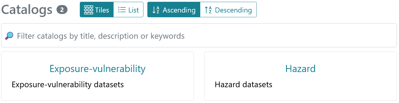
- Select from six hazard and four exposure-vulnerability categories:
- Hazard: Flood, Precipitation related, Temperature related, Wind related, Environmental, Multi-hazard
- Exposure-vulnerability: Population, Buildings, Infrastructure, Land use
Tip
Catalogs can be filtered by title, descriptions, and keywords. Additionally, datasets can be filtered by selecting attributed keywords.
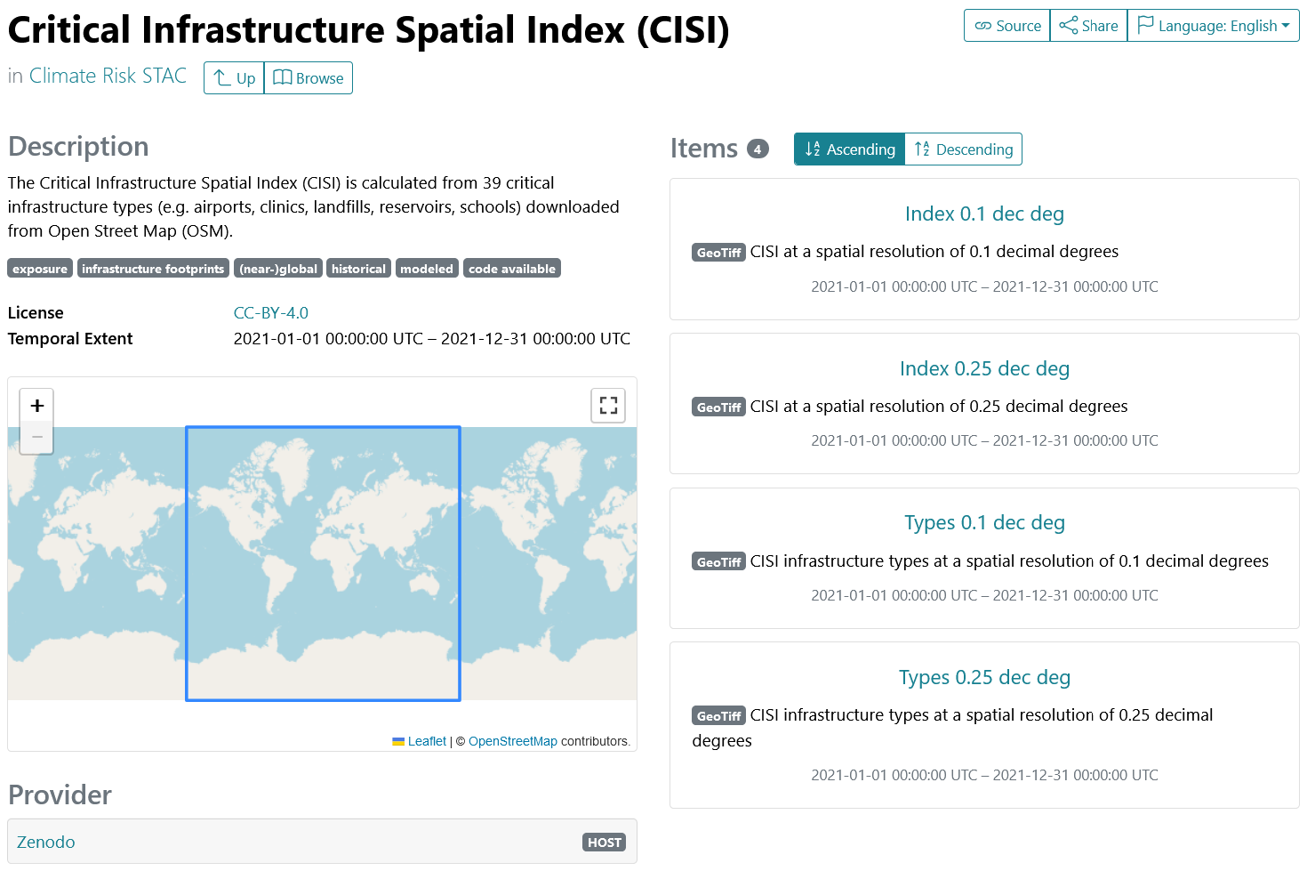
- Choose a dataset from the listed data sources (‘collections’). Collections contain the metadata attributes that all data entries have in common (e.g. keywords, license, temporal extent, data provider):
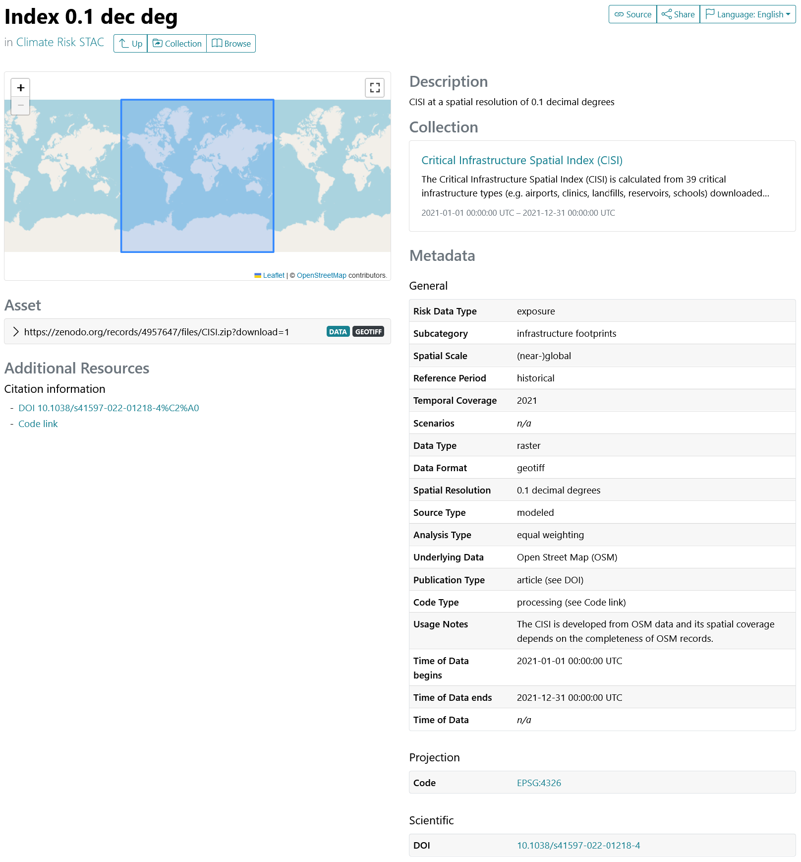
- Choose a specific data entry (‘item’) . Items list a range of metadata attributes including at least one asset, provides access to the data download: